

GPS lamps and the (in)visible landscape of the networked city
Satellite Lamps is a project investigating one of the most important contemporary infrastructures, the Global Positioning System or GPS. It’s a project curated by Einar Sneve Martinussen, Jørn Knutsen and Timo Arnall as part of the Yourban research project at the Oslo School of Architecture and Design and continues their previous work on revealing the materials of technologies that started in 2009 with RFID and Immaterials: Light Painting Wifi. The project uses Arduino extensively, and is also thoroughly documented:
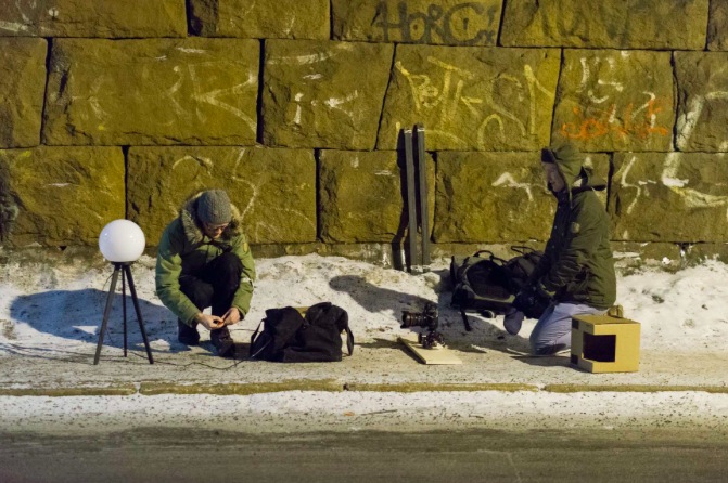
GPS is widely used yet it’s invisible and few of us really have any idea of how it works or how it inhabits our everyday environments. We created a series of Lamps that change brightness according to the accuracy of received GPS signals, and when we photograph them as timelapse films, we start to get a picture of how these signals behave in actual urban spaces.
They published a film that you can watch above, and published an article that details very thoroughly how it was made and why. If you are interested in the project, you can read more on how they explored GPS , how the visualisations were made, and about the cultural history of GPS.
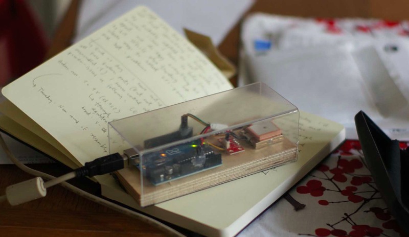
This is a GPS receiver connected to Arduino that sends data to a piece of software running on a laptop. It is a quickly designed tool, a transparent plastic box that that allows us to observe the performance of the electronics, and still mobile enough to carry in hand or a backpack.